Algorithms
What are algorithms?
Algorithms let you configure what you would like to count & measure - such as cars, trucks, or foot traffic. Each algorithm is tied to a particular data source, such as a satellite imagery provider - so by choosing an algorithm, you are also implicitly making a choice of data source.
Algorithms are configured within projects. Each project may utilize multiple algorithms.
To learn more about algorithms, click here.
Select Algorithms
You may select algorithms once you have created AOIs within your project. (Note: you can continue to edit AOIs even after selecting algorithms.)
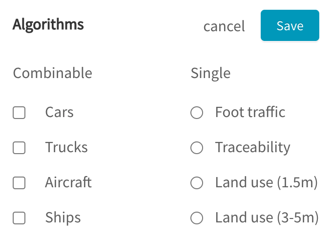
Under the Algorithms panel, click  , then select from the list of algorithms:

Generally available algorithms
Algorithms listed under the "Combinable" section can be combined in the same project. Those listed under the "Single" section cannot be combined with other algorithms in the same project.
Selected algorithms apply to all AOIs in a project
All AOIs in a project will be analyzed with the same set of selected algorithms.
In the future, we are looking to improve the flexibility of projects to allow subsets of AOIs to be paired with different algorithms.
Algorithms
The algorithms on GO may be split into roughly 3 broad categories. Click on each section to learn more about the algorithms.
- Object Detection: detect individual objects in satellite imagery
- Cars
- Trucks
- Aircraft
- Ships
- Geolocation: analyze location data from connected / IoT devices
- Foot Traffic
- Traceability
- Land Use: perform land use (land cover) classification on satellite imagery
- Land use (1.5m)
- Land use (3-5m)
Data Sources
Each algorithm is tied to specific data sources that it has been trained on. Click here for an overview of all the data sources that are available.
Updated over 3 years ago
Learn more about the available algorithms and their associated data sources: