AOI Catalog
The AOI catalog provides a set of ~3.7 million global, readily available AOIs for analysis in your GO projects. Key features include:
- Global coverage
- Broad range of AOI categories & types: retail, commercial, industrial, leisure, military, etc
- Search for AOIs by name, category / type, company, country / state
- Includes AOIs curated by Orbital Insight as well as from OpenStreetMap and other sources
Available AOIs
The following shows an overview of available AOIs in the AOI catalog:
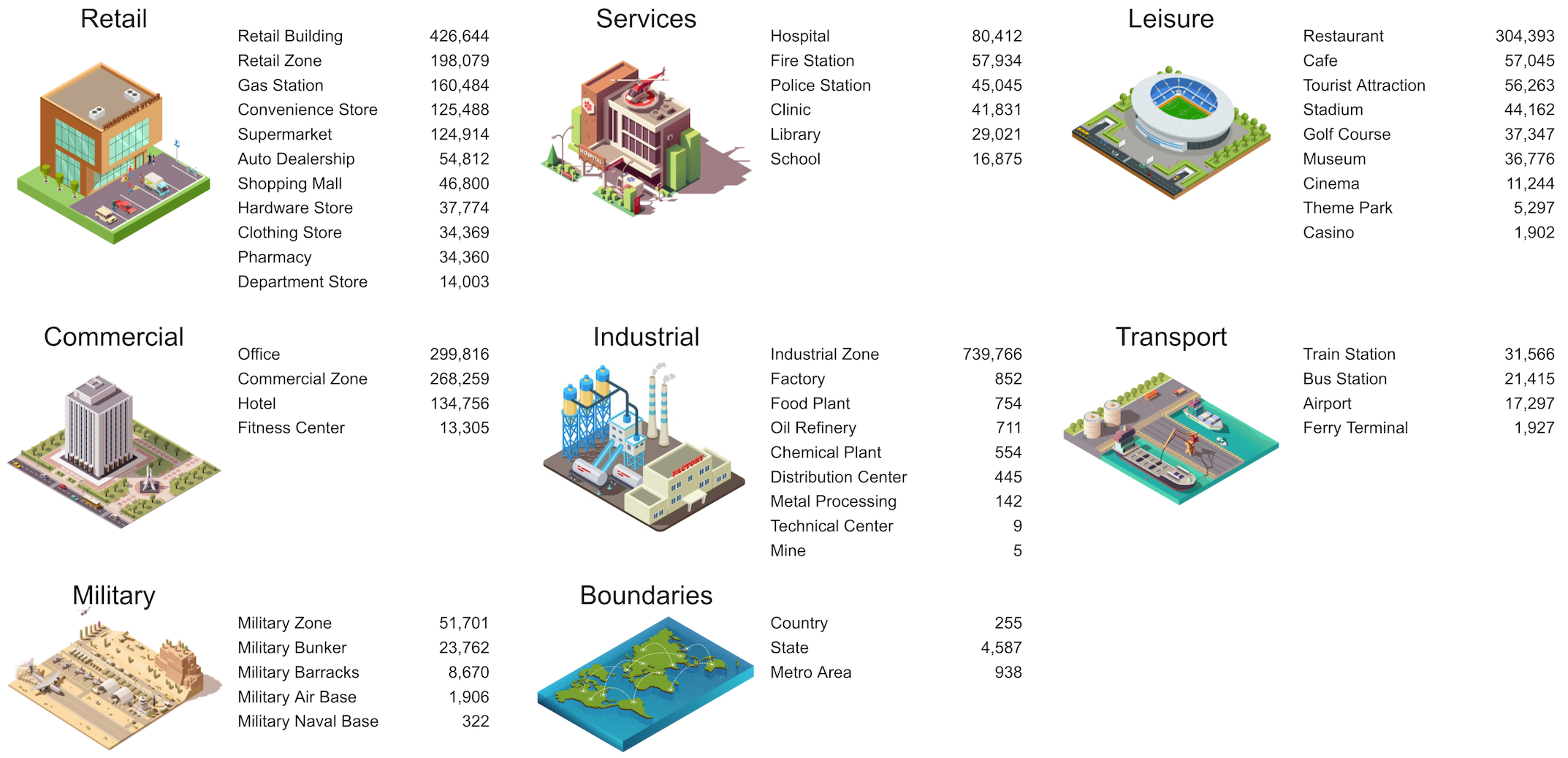
AOI catalog overview, with category & type hierarchy. The number of available AOIs is shown beside each AOI type (actual numbers may differ over time, due to updates to the catalog).
The AOI catalog is organized with a hierarchy of AOI categories (Retail, Commercial, Industrial, etc.), each of which contains multiple AOI types. For instance, Retail Building and Convenience Store are types that belong under the Retail category.
In addition, each AOI has a name and potentially multiple tags associated with that AOI that provide additional context. The list of Ford factory catalog AOIs below shows
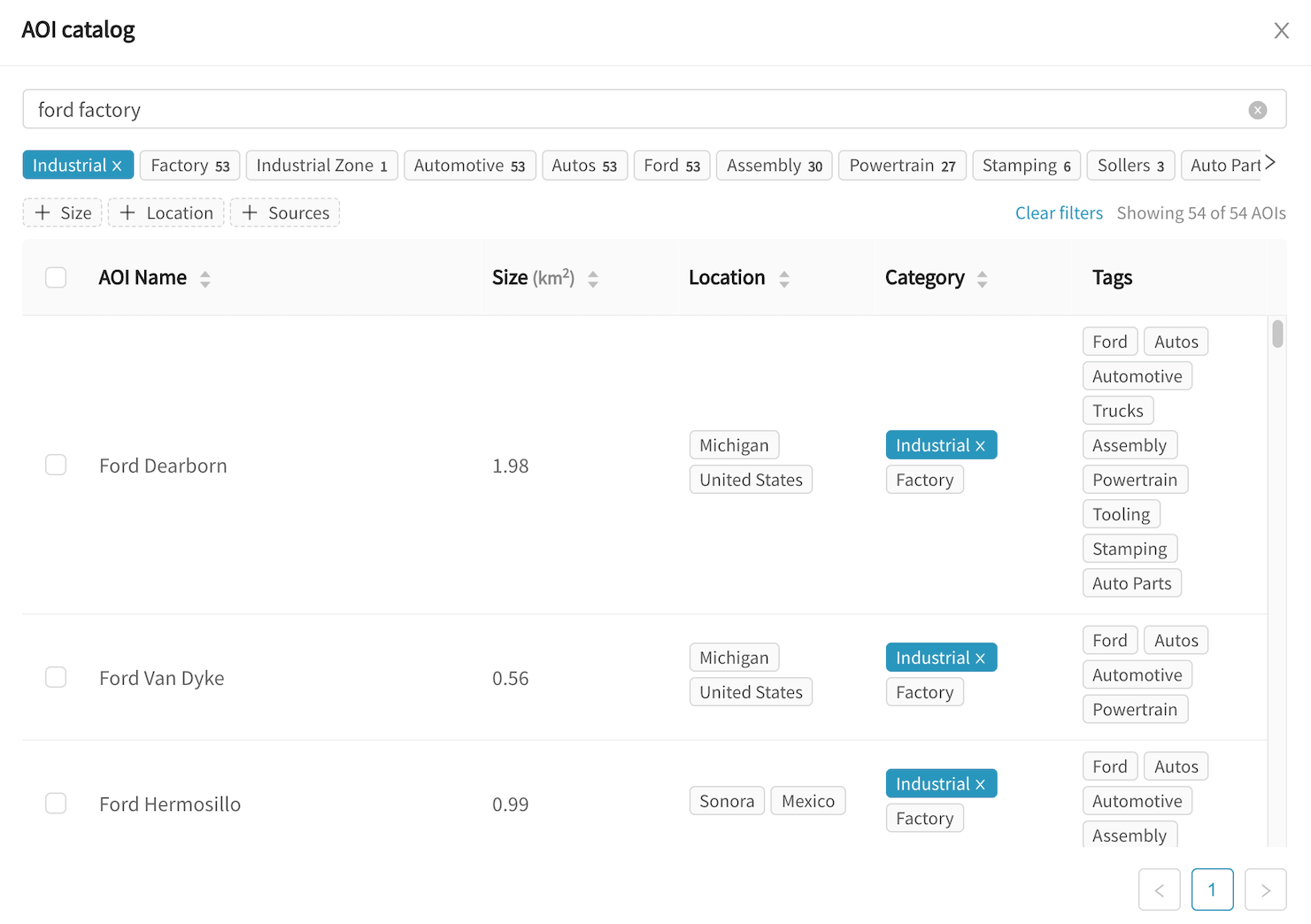
Ford factory AOIs in the catalog with their corresponding country & state, the "Industrial" category, "Factory" type, and various tags describing each AOI.
Browsing
To browse the AOI catalog, first go to a new or existing project where you are still configuring AOIs. Click the  button on the map view to open the AOI catalog.
When opening the AOI catalog, you will be presented with a set of categories, types, and tags with which to browse through the catalog. Clicking on any of these will narrow down the list of search results.
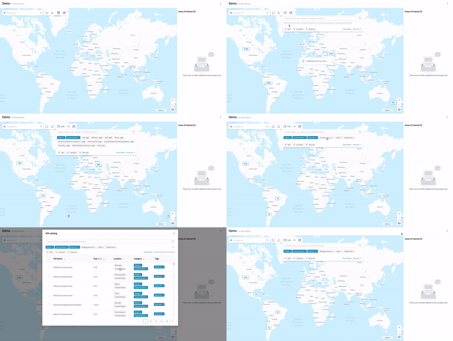
Browsing through categories, types, and tags
In the example above, we click through Retail (category), Supermarket (type), and then Walmart (tag) to filter for Walmart supermarket AOIs available globally. We then click "View list" to look at the results in table form.
As you browse, the number of available AOIs is updated next to the  icon. The map will also display clusters indicating the approximate distribution of search results.
AOI catalog results are limited to your map view
Your map view controls the geographic boundaries of AOI catalog searches. In the example above, we are zoomed out to a global view, allowing us to search the catalog globally.
If you are unable to find the right AOIs in the catalog, check that you are zoomed to the relevant areas on the map, then click "Re-do search in current map boundary".
Searching
Alternatively, you may perform a free-text search, by typing in the AOI catalog search box and hitting Enter:
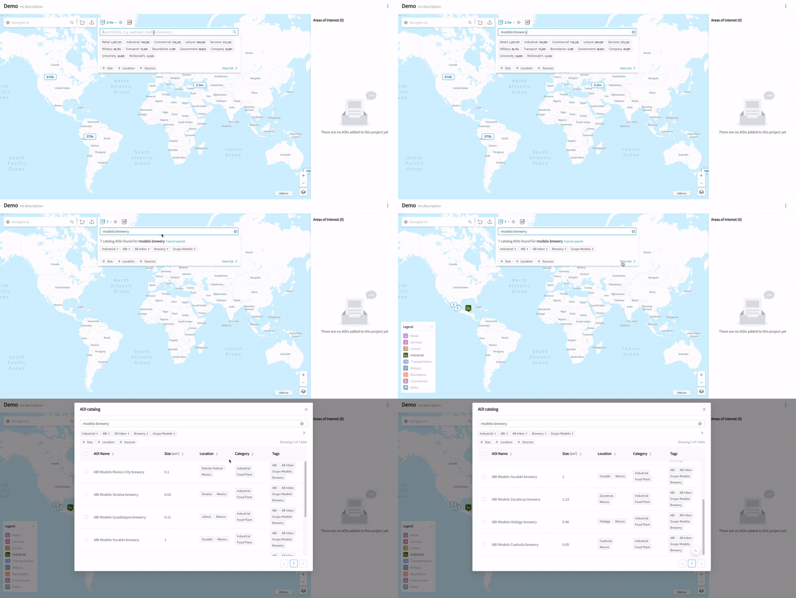
Free-text search in the AOI catalog
In the example above, you may notice that we were able to see individual AOIs on the map. This is because once there are <500 results - we display the individual AOIs on the map.
The AOI search matches against all of the following fields for an AOI:
- Name
- Category
- Type
- Tags
- Location (Country / State)
Searches are case-insensitive, and may be partial matches against the AOI fields.
For example, you might try the following searches:
- "exxon refinery" (matches against
ExxonMobiltag andOil Refinerytype) - "russia air base" (matches against
Russiacountry andMilitary Air Basetype)
Filtering Results
At any point, whether browsing through categories / types / tags, or doing free-text search, you may do additional filtering based on AOI size, location (country / state), or data source.
Simply click on "Size" / "Location" / "Sources", then add the filter:
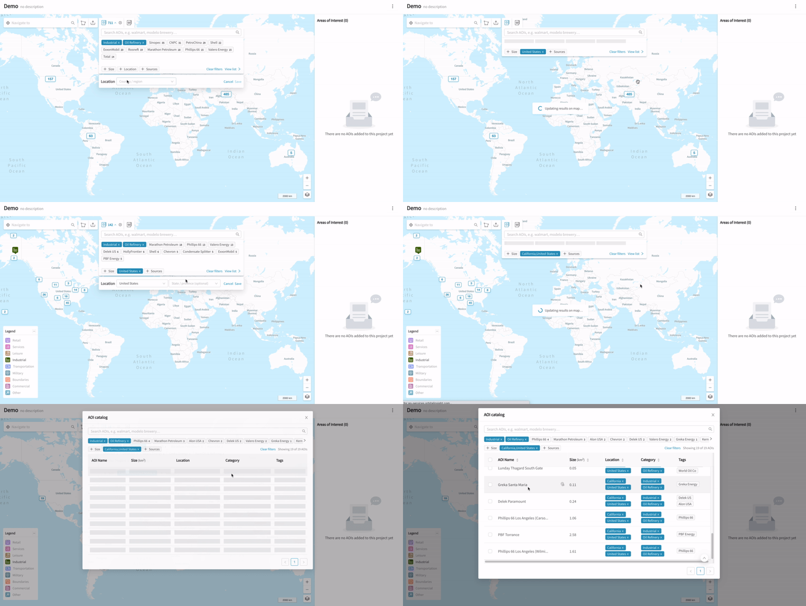
Filtering oil refinery AOIs by country and state
Adding AOIs to a Project
When you have found your desired AOIs, you may add them to your project in several ways.
Directly from the map
If you have <500 search results, the AOIs will be displayed individually on the map. You may click on these AOIs to zoom into that AOI. As you hover your mouse over each AOI, a popup will appear with details for that AOI.
In the example below, we use the Shift-Click shortcut to select multiple catalog AOIs to add to the project. We can also add individual AOIs by clicking on "+ Add" in the popup.
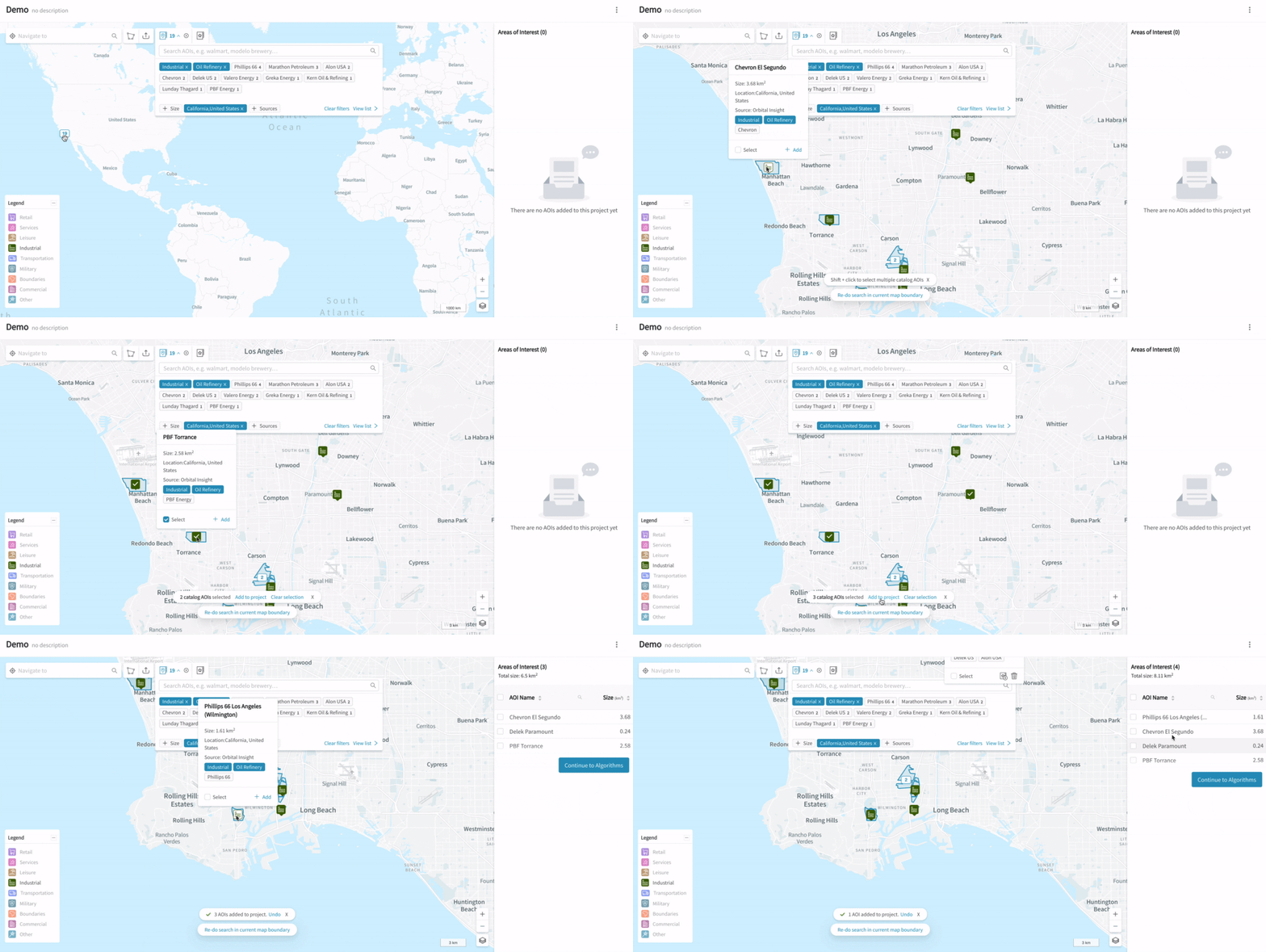
Adding catalog AOIs to a project directly from the map
From the catalog results list
Alternatively, you may go through the list of results by clicking on "View list", then using the checkboxes in the table to select all the AOI results (or a specific set), and finally clicking on "Add to project":
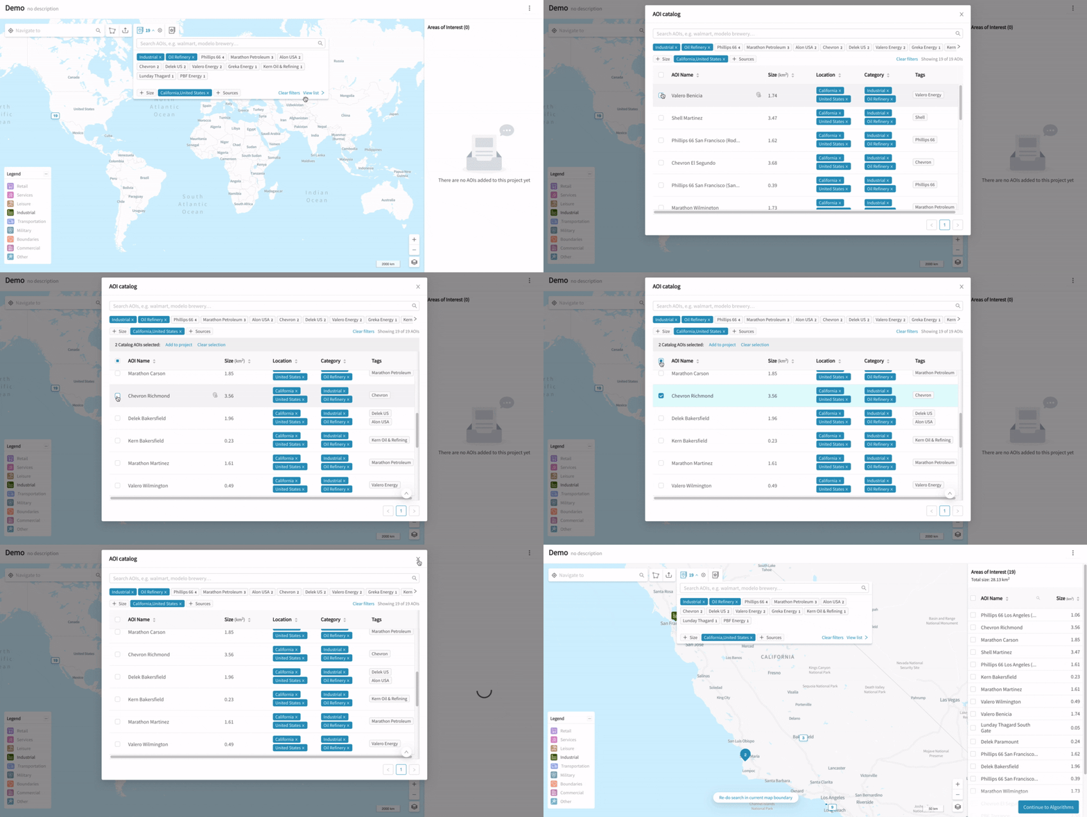
Adding catalog AOIs to a project from the results list
FAQs
-
Is the AOI catalog available to me?
The AOI catalog is available to all GO users, at no extra charge. -
How complete is the catalog?
The catalog is an incomplete sample of all possible AOIs that might exist in the world. In early testing, we have found that most AOIs that users care about are available. However, we will strive to improve coverage in important areas over time. -
How accurate are the AOIs? Are they vetted by Orbital Insight?
Catalog AOIs with “Orbital Insight” as the source are fully vetted by us. AOIs from other sources such as OpenStreetMap are provided as-is - no guarantee is made of correctness. -
How often is the catalog refreshed?
We aim to refresh the open source AOIs (eg those from OpenStreetMap) every 6-12 months. The current set of OpenStreetMap AOIs are from October 2020. -
I cannot find some AOIs, what can I do?
The catalog search is constrained to the area you are currently zoomed into on the map. You may need to zoom out and pan the map to the right area, to find the right AOIs.
If you’re not sure, zoom out to the global map view and search from there.
Alternatively, you may need to remove some filters from the search. -
How do I find AOIs for company X?
Try searching for company X in the AOI catalog search box. Also check that your map is zoomed to the approximate area in which you expect the AOIs to be.
Please note that the catalog may not contain all of company X’s AOIs. -
Can you help me add some AOIs to the catalog?
Please contact us with your request. -
Can I edit the category / type / tags metadata for my own AOIs?
This is not currently possible. However, we are working to enable this in future. -
How is the location (country & state) of AOIs determined?
We use a global set of country (admin level 0) and state/region (admin level 1) boundaries from NaturalEarth (v4.1). For disputed regions, we make no adjudication and use the boundaries as-is.
For AOIs that lie outside these boundaries, we assign country/state based on the closest admin boundary within ~50 kilometers. Any AOIs that are further out to sea will not have an assigned country/state.
This location methodology is also automatically calculated for all project AOIs.
Updated about 3 years ago