Object Detection
Object detection is a category of computer vision (CV) classification algorithms in GO that operate on satellite imagery to identify & count individual objects that appear in the imagery.
The following table summarizes the generally available object detection algorithms, in terms of resolution and output:
| Algorithm | Imagery Source | Applicability | Output Classes | Output Geometry |
|---|---|---|---|---|
| Cars (Pleiades) | Airbus Pleiades 50cm, panchromatic (black & white) | Global, wide-area | Single Class | Point |
| Cars (Skysat) | Planet Skysat 50cm, visual (pansharpened color) | Global, urban areas & carparks | Single Class | Bounding box (rotated) |
| Trucks (Pleiades) | Airbus Pleiades 50cm, panchromatic | Global, wide-area | Single Class | Point |
| Railcars (Skysat) | Planet Skysat 50cm, visual (pansharpened color) | Global, train stations | Single Class | Bounding box (rotated) |
| Aircraft (Pleiades) | Airbus Pleiades 50cm, pansharpened (color) | Global, airports | Multi-Class | Bounding box (axis-aligned) |
| Aircraft (Skysat) | Planet Skysat 50cm, visual (pansharpened color) | Global, airports | Multi-Class | Bounding box (rotated) |
| Ships (Skysat) | Planet Skysat 50cm, visual (pansharpened color) | Global, littoral (coastal) areas | Multi-Class | Bounding box (rotated) |
| Ships (Dove) | Planet Dove 3-5m, color | Global, littoral (coastal) areas | Single Class | Point |
- Imagery Source: click here for more details on imagery data sources.
- Applicability: the areas and conditions under which the algorithms are expected to perform well.
- Output Classes: whether the algorithm identifies objects without further classification (single class), or differentiates between classes of the object (multi-class; eg fighters vs commercial aircraft)
- Output Geometry: whether the algorithm identifies objects as points or bounding-boxes (see examples below)
Global applicability
Our object detection algorithms are built to work globally, by using a training dataset that is geographically diverse. For example, the Cars algorithm is trained on satellite imagery from the Americas, Europe, Middle-East and Asia, so that it learns to recognize cars in different parts of the world (as the objects, as well as the background environment, may look different!)
Wide-area applicability
Algorithms that are applicable on a "wide-area" basis mean that they are trained to distinguish the relevant objects amidst a highly variable background in the satellite imagery. This means that you do not have to worry about limiting your AOIs only to areas where you would expect the objects to appear.
For example, if using the Cars algorithm, you do not have to worry about having individual carpark AOIs - simply analyze entire facilities / AOIs and the algorithm will automatically pick out the cars in the relevant spots.
Cars
Cars (Pleiades)
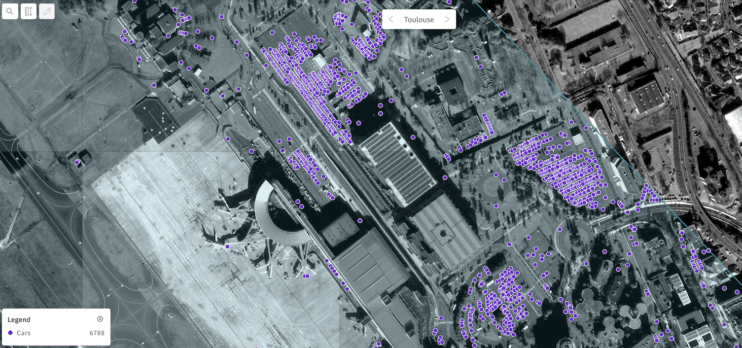
Car detections at Toulouse airport - as points
Cars (Skysat)
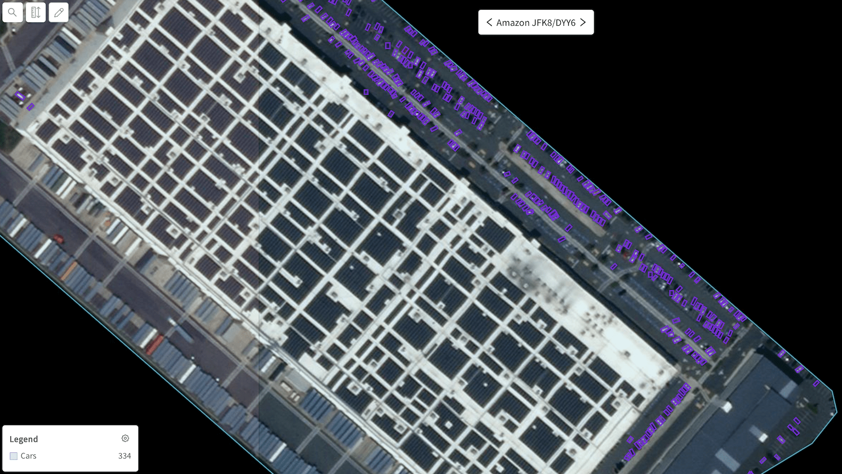
Car detections at an Amazon warehouse - as rotated bounding boxes
Trucks
Trucks (Pleiades)
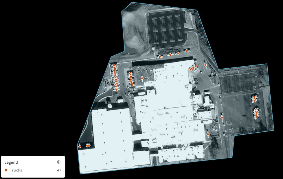
Truck detections at a factory
Railcars
Railcars (Skysat)
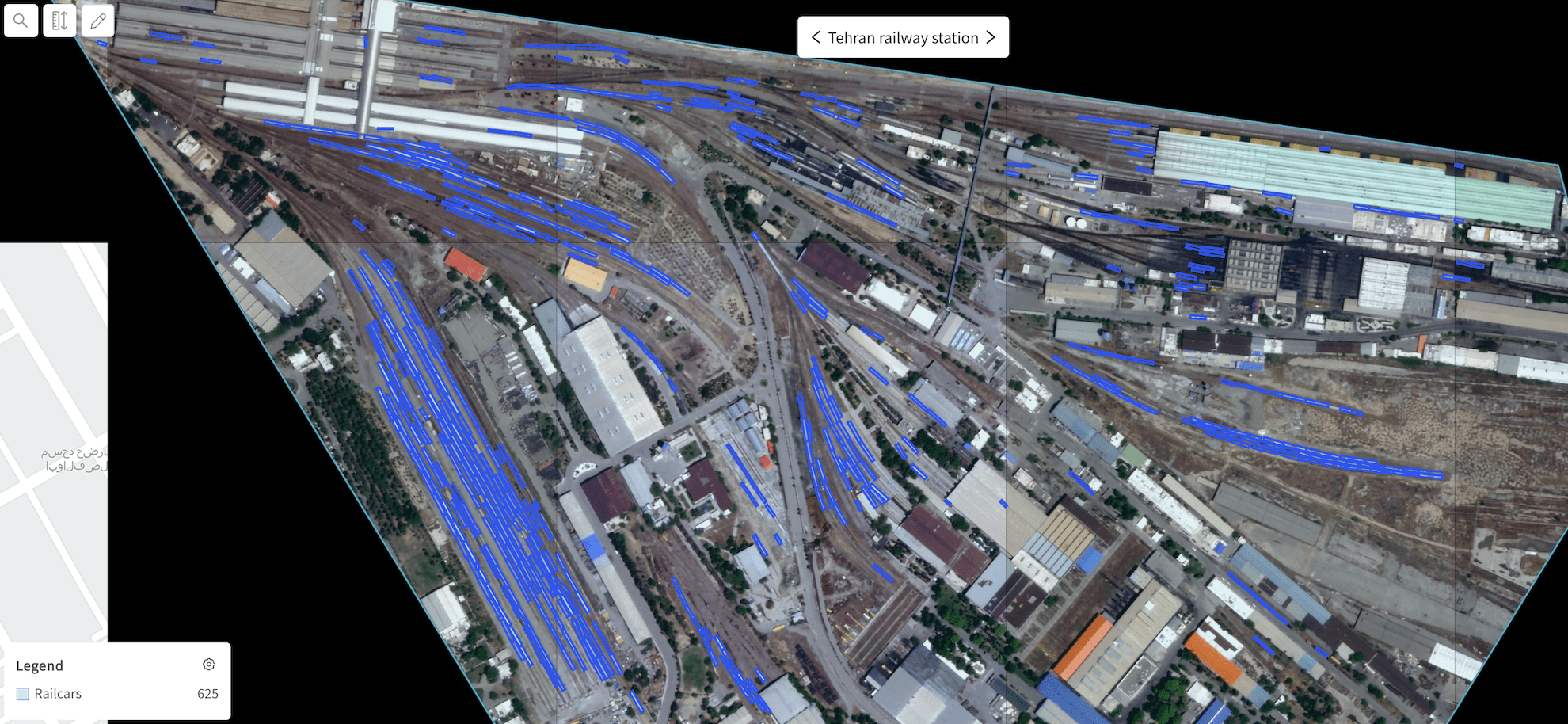
Railcar detections at the Tehran railway station
Aircraft
Aircraft (Pleiades)
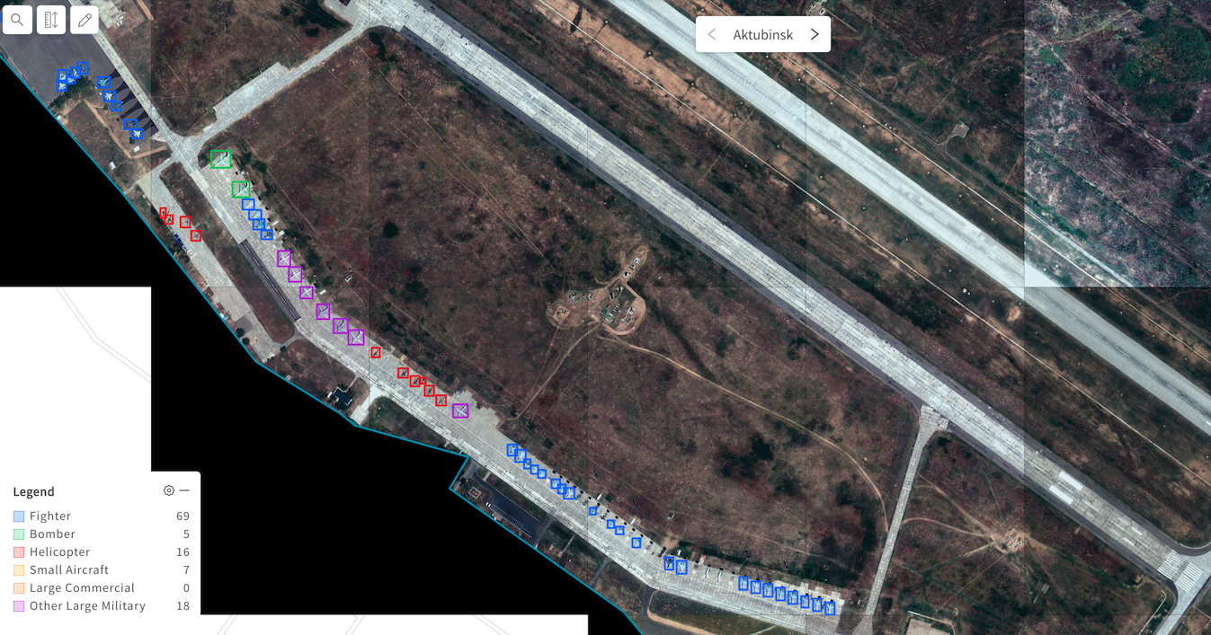
Aircraft detections at a Russian air base - as axis-aligned bounding boxes
Aircraft (Skysat)
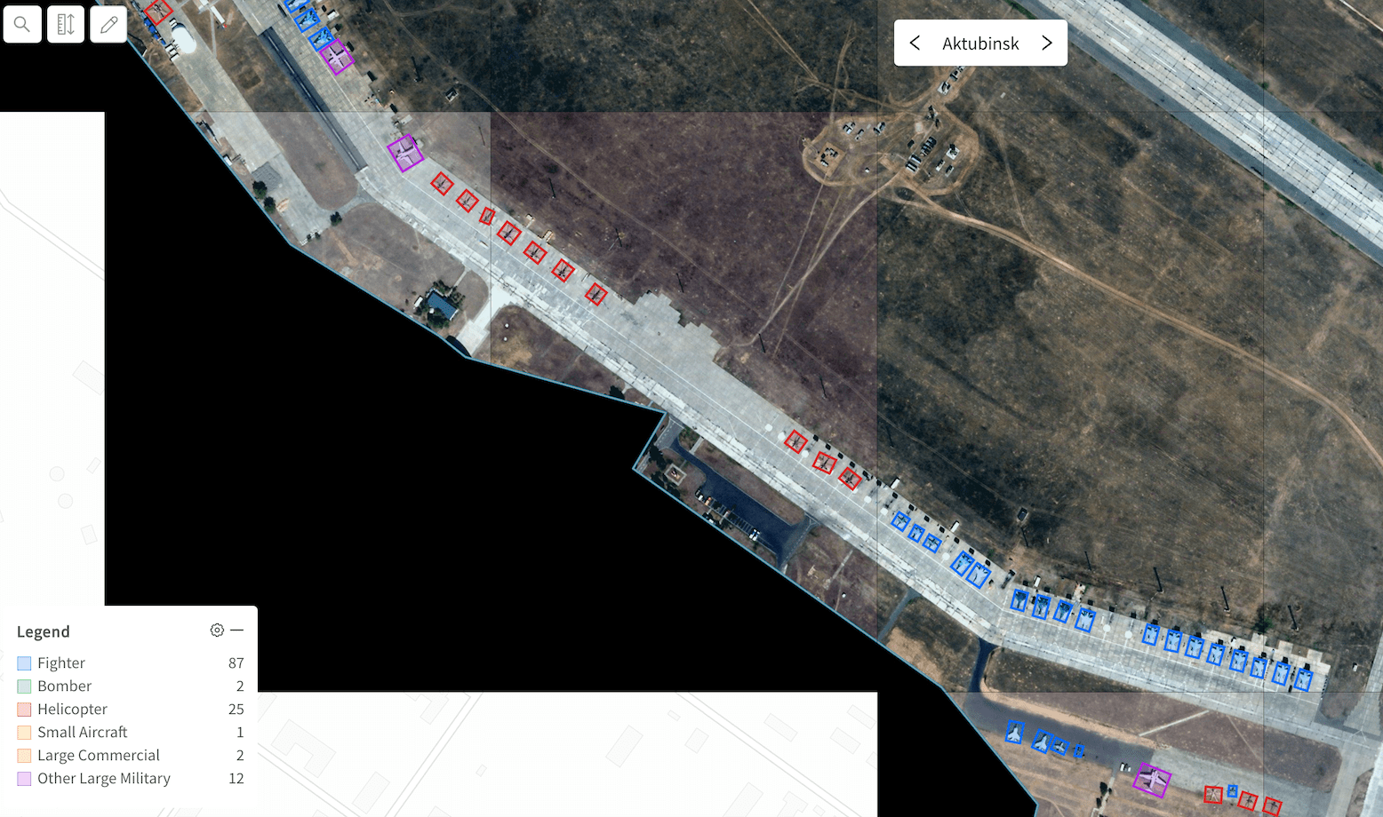
Aircraft detections at a Russian air base - as rotated bounding boxes
Ships
Ships (Skysat)
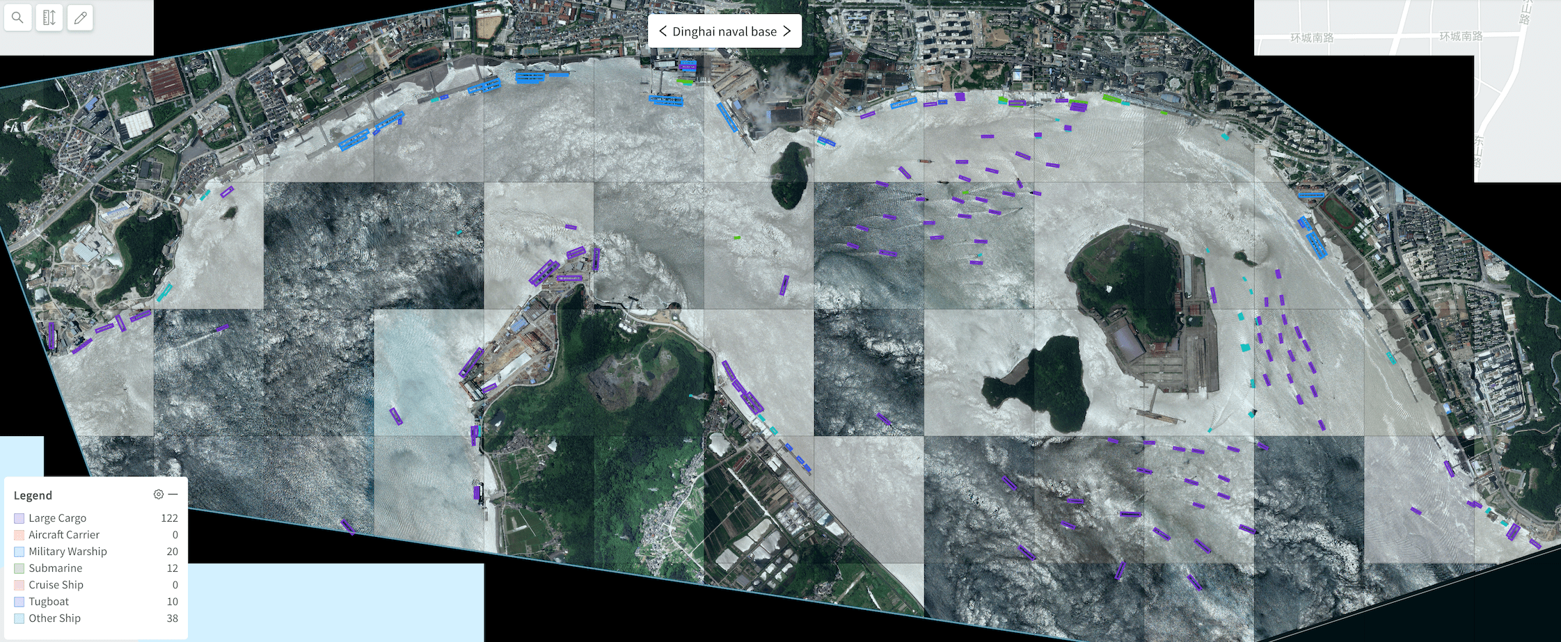
Ship detections at a naval base - multi-class rotated bounding boxes
Ships (Dove)
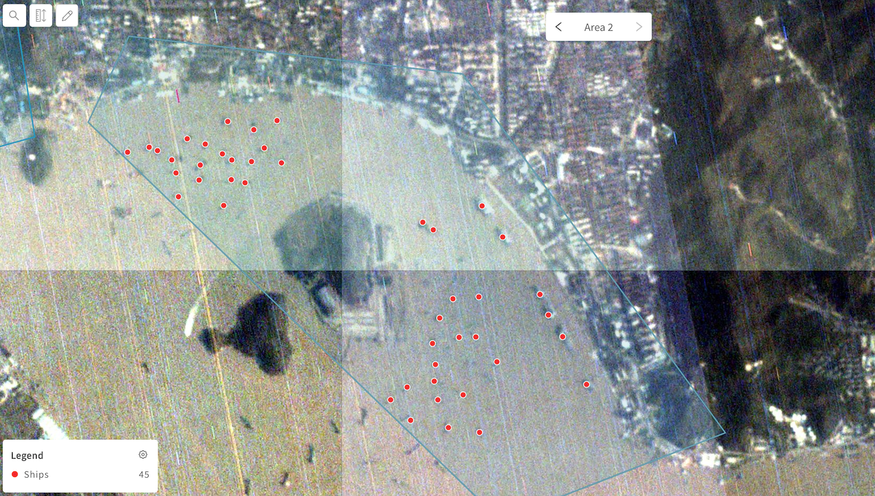
Ship detections at a port - as single-class points
Updated almost 3 years ago
Learn how to select imagery for your object detection projects, and view results