Spatial Results
Spatial results data consists of geometries (points, bounding boxes, polygons, etc) in geographic coordinates. Spatial results are produced for the following algorithms:
- Object detection: where the detected objects are within each image
- Foot traffic heatmaps: where devices are found within your AOI
- Traceability: where devices come from before / go to after being at your AOIs
- Land use: areas of each land use class within your AOI
Interacting with Spatial Results
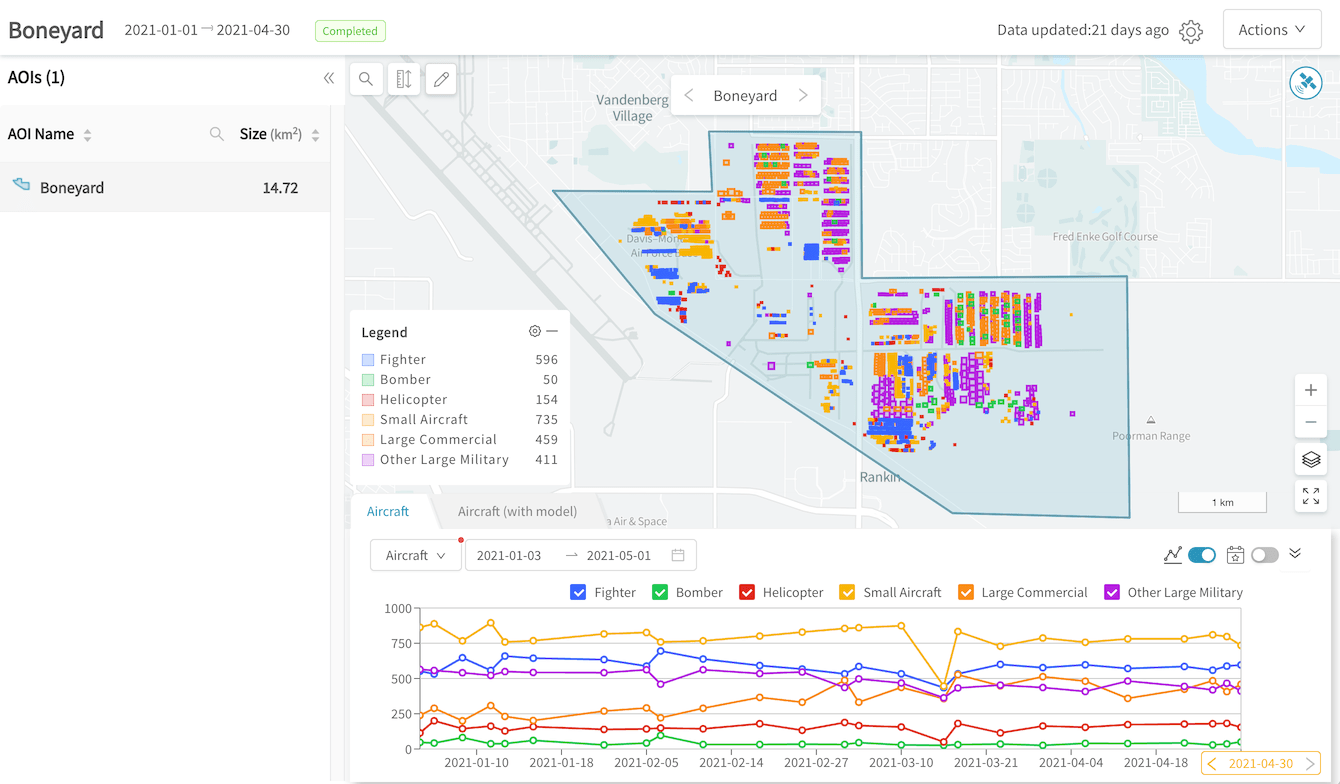
Spatial results are displayed in the map view in the results page for your GO project:

Spatial results in the map view on the results page
From here, you may:
- Show thumbnails for the corresponding satellite scene by clicking on
 in the top-right corner
 - Change basemaps for the map view by clicking on
 in the bottom-right corner
 - Show/hide results layers by clicking on layer names in the legend
- Tweak opacity & size of visualizations by clicking on legend settings

- Measure distances and sizes by using the measurement tool
 in the top-left corner
Land use - thumbnail limitations
Currently, if thumbnails are turned on for a land use result, we only display the most recent image even if multiple images were analyzed. This is a known shortcoming that we are exploring solutions for.
Updated about 3 years ago