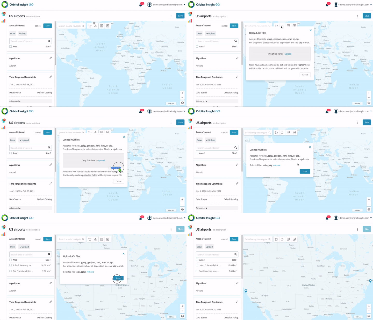
Upload AOIs
You may also upload AOIs from an existing GIS workflow (eg QGIS, ArcGIS).
Click on  , then select a file or drag-and-drop it from your computer into the upload modal:

Uploading a file with AOIs
Supported file formats include:
- Shapefile (.shp): note that all dependent files (.dbf, .prj, .shp, .shx, etc) should be zipped & uploaded as a .zip file
- GeoPackage (.gpkg)
- GeoJSON (.geojson)
- KML (.kml)
- KMZ (.kmz)
Parsing of fields in your file
The following case-sensitive fields are parsed and saved for your AOI:
name: this becomes the AOI nametags: this should be comma-separated, and populates the list of tags for each AOI. (In future, we will support editing of AOI tags & enable their use for more advanced aggregation and analysis)All other custom fields will be parsed and put into an
attributesfield in GO. These attributes are accessible if you subsequently download the AOIs out of GO, or via the API.To learn more about AOI metadata, click here.
Protected fields
The following fields are ignored & dropped when parsing your AOI file:
id,aoi_id,category_id,aoi_type_id,data_source_id,centroid,area,created_on.
Potential Errors
AOIs does not use WGS84 coordinate system
AOIs has inverted polygons
Updated over 2 years ago