Data Sources
The following are the generally available imagery and geolocation providers, accessible to all customers on GO.
Imagery
| Provider / Constellation | Coverage | Resolution | Historical Data |
|---|---|---|---|
| Airbus Pleiades (PHR 1A / 1B) | Global | 50-70cm | From March 2012 |
| Airbus SPOT (SPOT 6 / 7) | Global | 1.5m | From October 2012 |
| Planet Dove | Global | 3-5m | From June 2016 |
| Planet Skysat | Global | 50-90cm | From January 2020 |
Geolocation
| Provider | Coverage | Historical Data | Latency |
|---|---|---|---|
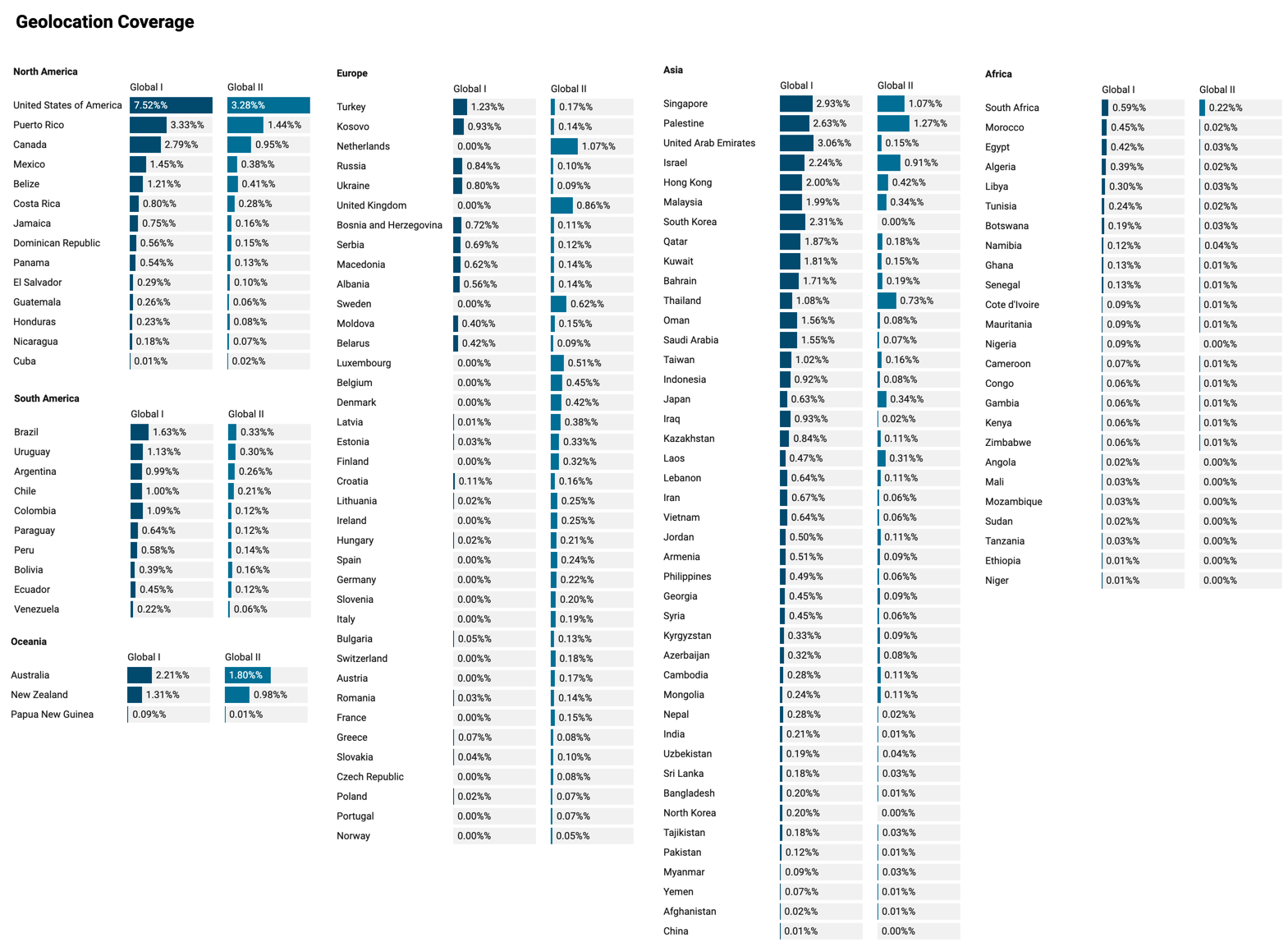
| Global I (previously "Global") | - North America - South America - Asia - Middle East - Oceania - Africa | 1 January 2018 - Current | <4 days |
| Global II | - North America - South America - Asia - Middle East - Oceania - Africa - Europe | 1 June 2019 - Current | <8 hours |
| Japan | Japan | 1 September 2019 - Current | <4 days |
| US-Only (being deprecated) | USA | 1 January 2018 - 11 August 2021 | <4 days |
New data is available daily and will be processed if you configure an open-order project.
Global Geolocation Coverage

Click to see full image.
Updated about 3 years ago